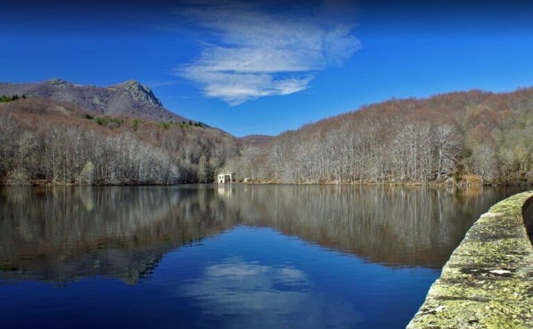
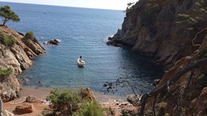
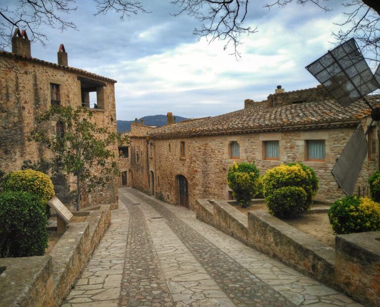
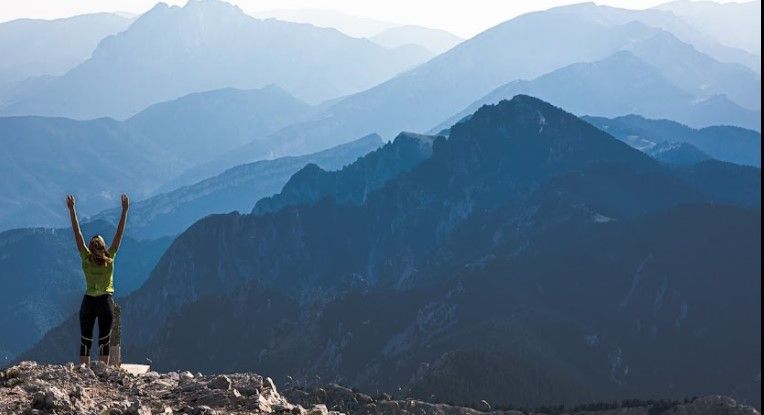
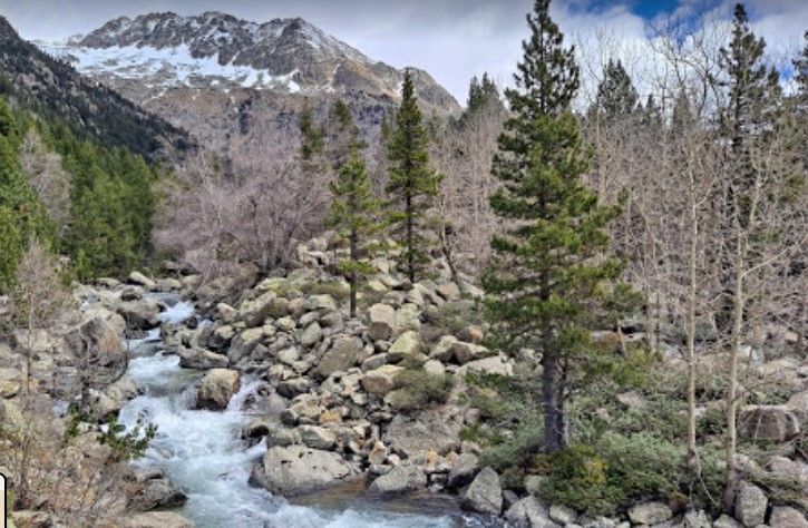
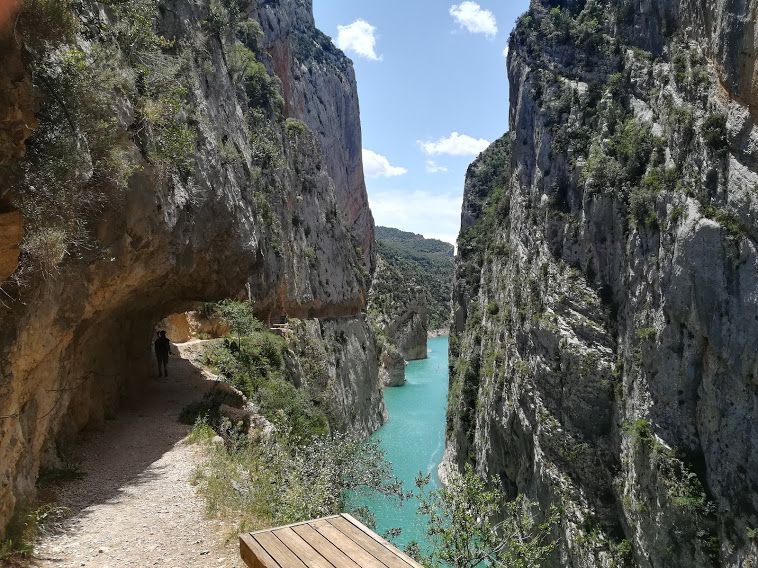
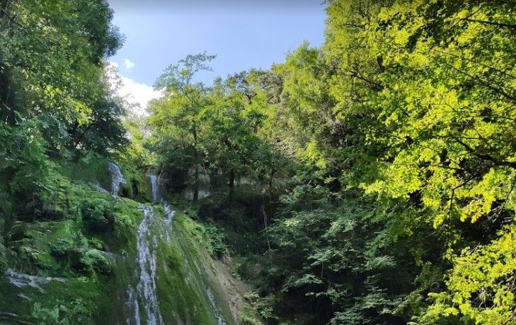
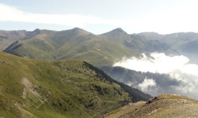
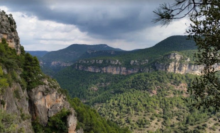
Do you want to practice trekking in Catalonia?
The nature and landscape of the Catalan territory are the perfect setting for this activity, one of the best ways to spend quality time outdoors. That’s why in this post we tell you the best routes for hiking and trekking in Catalonia. Don’t miss them!
Trekking route through the Montseny mountain range
One of the most wonderful places in Barcelona is undoubtedly the Natural Reserve of Montseny. This is one of the most outstanding mountain routes inĀ Barcelona, and one of the best natural parks in Catalonia.
The Turó de l’Home is the highest mountain of the Montseny massif with a height of 1708 m. However, it is a mountain accessible to all and ideal for beginners in the world of trekking and hiking.
This route starts on the side of the road uphill for 1 km to the Passavets parking lot, where there is a fountain, perfect for a break, refill your water bottle and recharge your batteries. From here you just have to follow the green pylons to the top, the path zigzags up and you can’t miss it.
The Matagalls is another of the peaks of Montseny and is also a classic for hikers in the area. It is possible to follow different routes to reach the summit depending on the difficulty and the time you want to invest. The best known is the route that starts in Collformic, but you can also start from Sant Bernat or Sant MarƧal. We especially recommend the Sant MarƧal route, which starts at La Taula dels tres bisbes. It is the hardest because of its slope, with initial ramps of up to 32% inclination, but the “fagedes” (beech forests) that surround the road up to the Matagalls ridge are fairytale-like and make it very worthy of the effort. And if you have a picnic there, even better!
Trekking route in Sant Feliu de GuĆxols - Palamós
If you take a look at our hiking routes and excursions along the Costa Brava, you will see that it is one of the most representative places for trekking in Catalonia. Its well known CamĆ de Ronda is almost a must for nature and outdoor sports lovers. This route is designed to be covered in several days, with distances that can be extended up to 140 kilometers to be done in eight days of trekking.
If we had to highlight any of these stages, we would choose the one that goes from Sant Feliu de GuĆxols to Palamós. With just over 17 kilometers, it accumulates a positive slope of around 250 meters, which makes it affordable for all levels, since it can be covered in just over five hours without excessive problems.
Along the route, perfectly signposted, you will enjoy a parade of viewpoints overlooking the Mediterranean and its cliffs. And in the middle of the way you have a stop in Playa de Aro, one of the neuralgic points of the area that you can’t miss. Take advantage and take a look at our hiking routes and excursions in Palamós.
Trekking route in Pals
Just 25 minutes by car from Playa de Aro, we find the medieval town of Pals, another of the villages of the Costa Brava where some of the most symbolic trekking routes in Catalonia are located.
As you stroll through its cobblestone streets, between walls and churches, and feel like you are traveling back in time, we recommend you take advantage of the day with these two routes that we present to you.
The route of Quermany Gros, Petit, Minas and Riera de Quermany, is a trekking route of just over 10 kilometers, in which two simple summits are made from which you will have privileged views of Pals and its surroundings. Further on, you will reach the White Clay Mines, where you can get close to some fairytale caves. The circular route is completed in just over five hours at a leisurely pace.
On the other hand, if you have more time, you can also enjoy an alternative route along the coast and rice fields. Also circular and leaving from Pals, the route goes directly to the coast, where you can explore the beach of Pals to return to the village by a route of rice fields. You will spend the whole day to cover almost 25 kilometers, but it will be an unforgettable experience.
Take advantage and check out our hiking routes and excursions in Pals!
Trekking route in Cavalls del Vent
If you are ambitious and always looking for longer distances, more altitude, and more elevation gain, your route is Cavalls del Vent, a spectacular circular route in the Catalan Pyrenees of more than 80 kilometers and 5,600 meters of positive elevation gain. This circular route connects the different shelters of the CadĆ-Moixeró, one of the best forests in Barcelona, in the regions of BerguedĆ”, Alto Urgel and Cerdanya.
The origin of this crossing comes from the year 2003, when the guards of the shelters of the Natural Park of CadĆ-Moixeró thought about this itinerary. The name Cavalls del Vent refers to the Catalan translation of the Tibetan word for the Buddhist prayer flags that are placed on the peaks of the Himalayas to send prayers of peace and brotherhood.
It is, of course, very physically demanding, but it has an infrastructure of shelters and lodging that will allow you to complete it in several days. If you feel up to it, this is one of the experiences that every mountain and trekking lover must live.
Don’t miss this trekking route in the Pyrenees!
Trekking route in the Natural Park of Aigüestortes
The natural park of Aigüestortes, which receives more than half a million visitors each year, is located in the northwestern corner of Catalonia, in the province of Lleida, in the heart of the Pyrenees mountain range. As it has multiple routes and places for hiking, we are only going to mention the most popular ones.
If you like the high route, you will definitely like the Carros de foc. This park treasures all the elements that characterize the high Pyrenean mountains and has water as a protagonist, whether in the form of snow, rivers, waterfalls or lakes. With its varied relief dotted with hidden shelters, it is the ideal setting for a high route, so you also have several to choose from.
Of approximately 8.9 km and of moderate-easy level, it also has the route of the lakes, which starts at the parking of the Pierró meadow, to follow the Sant Maurici lake and the lakes of Ratera and Amitges, offering a complete view of the valley of the Escrita river. You will see a total of 7 lakes along the route, with a view at all times of the Encantats, the most emblematic peak of the park.
Do not miss the viewpoint of the lake, just 5 minutes from the main road, near the lake of Ratera, and while you’re near, take advantage and visit the most beautiful villages of Lleida.
Trekking route in the Montrebei Gorge
This route allows us to discover the spectacular gorge of Mont-rebei accessing it from the Pallars JussÔ. The excursion starts at the Masieta and Horta del Pinell parking lot and from this point you reach the gorge through the suspension bridge of the Sant Jaume ravine. After crossing the entire Mont-rebei gorge along the spectacular path carved into the rock, you finally go down the small Seguer gorge to the Montfalcó bridge.
With distance hikes that do not exceed 14 km in length and 600m in elevation gain, its difficulty is quite moderate. However, be careful! The route through the gorge, although technically not technically difficult, can be somewhat dangerous. It is equipped with handrails installed on the rock wall, but there is no protective railing on the cliff side, and the drop to the river varies from 40m to 60m. So beware, prevention is better than cure!
As this section is very cold in winter, we recommend doing this route in spring, when it is warmer but not as stifling as in summer. Don’t miss our route and excursion through the Congost de Montrebei!
Trekking route through the Bandolers Mine
In this trekking route, although most of the way is uphill, the level is moderate easy with intervals.
To start the route of this circular route of almost 9 km you must go to MolĆ Vell d’Hostalets de Bas, you will pass by the waterfalls of l’Ansat, the one of the Cristianos and the one of l’Olla agua. After reaching the fountain, the route continues up to the Grau d’Olot, where there are large curves known as “Las Marrades”.
When you reach the end of this route, you’ll feel like you’re traveling back in time. The reason? La Mina dels Bandolers, a well-known place in the area formerly used as a hideout for bandits. These attacked those who passed this way, so you’d better watch out just in case.
This route is very characteristic and really recommended as a trekking route in Catalonia, as it preserves the ancient aroma of past times as the cobblestones and several remarkable buildings, such as the Pont de l’Hostalot.
Did you know that Puigmal is the second highest mountain in Catalonia? At 2,910 m high, it is located on the border between Spain and France, specifically in Queralbs (Girona).This trekking route, of approximately 4.5 km, is very popular. It is also highly recommended for being one of the easiest, as it does not involve great physical or technical effort for mountaineers.
It starts at the parking lot of Fontalba, where you can follow two perfectly visitable and busy paths, one that goes to the Puigmal with a slight upward trend and another that will take you to the Sanctuary of NĆŗria. If the day is clear, the Puigmal is a rounded peak and easily identifiable with the naked eye. Although the climb is steep, you can make progress on the harder sections by zig zagging. Ascend the mountain ridge until you reach the Dou mountain range, then the summit of the Borrut and then the carena, first grassy and then more stony, to the top of Puigmal.
Watch out! We recommend you to be cautious with the fog and the Torb, a hurricane wind from the mountains of Girona, so before leaving the route better check the weather forecast.
Trekking route through Prades, Avencs and Avencots de La Febr.
This route is the best if you want to make a getaway with children in Catalonia, as the difficulty is moderate and has very little slope.
To start this fun 7 km route, you can leave the car near the Pla de Agustenc where several trails start. You must follow the white and yellow PR markers and then walk until you find a narrow path on your left that will take you to the edge of a crevasse. You will descend 30 m through the crevasses, which is unusual in most Catalan trails. To continue with the adventure you will have to go through the cave that leads to the second part of the excursion, to Prades, where the ascent to Tossal de la Baltasana begins.
Did you like our selection of the best trekking routes in Catalonia? Do you know of any other places for hiking and trekking? If you miss any of them and you think they deserve to be on our list, don’t hesitate to recommend them to us! š š